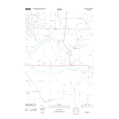
2013 Map of Bertram
USGS Topo · Published 2013About this map
The Cedar River carves a sweeping path through this Linn County landscape, defining the terrain at the Big Bend and influencing the layout of local infrastructure. To the north, Vernon View serves as a residential hub near the winding Indian Cr, while the settlement of Bertram sits at a strategic crossing near the Bertram Bridge. The map captures a mix of rural development and modern recreational spaces, from the Bever Zoo in the northwest to the Airport National Public Golf Complex near the town of Ely in the south.
Find a feature on this map
135 named features on this map. Tap any name to fly to it.
Don’t see what you’re looking for? This feature index may not catch every label — zoom into the map to look around manually.
Map Details
Editions of this 2013 Bertram Map
This is the sole edition of this map. No revisions or reprints were ever made.
Other maps of this area

1887 · Cedar Rapids
USGS Topo · 1:62,500

1888 · Marion
USGS Topo · 1:62,500

1889 · Marion
USGS Topo · 1:62,500

1890 · Anamosa
USGS Topo · 1:62,500

1891 · Mechanicsville
USGS Topo · 1:62,500

1891 · Cedar Rapids
USGS Topo · 1:62,500

1894 · Mechanicsville
USGS Topo · 1:62,500

1900 · Anamosa
USGS Topo · 1:125,000

1901 · Stanwood
USGS Topo · 1:125,000

1903 · Fairfax
USGS Topo · 1:125,000