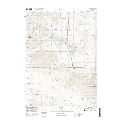
2015 Map of Bertram
USGS Topo · Published 2015About this map
The Cedar River carves a winding path through this Iowa landscape, where small communities like Bertram and Vernon View sit alongside the expanding southeastern reaches of Cedar Rapids. This 2015 survey reveals a terrain defined by its watercourses, including the convergence of Indian Creek and Squaw Cr with the main river channel. Traces of early settlement and genealogy remain in the numerous family-named burial grounds scattered throughout the township lines, such as Campbell Cem, Williams Cem, and the Moore-Skillman Cem near the riverbanks. The infrastructure reflects a blend of rural and suburban growth, featuring the historic Bertram Bridge and the residential clusters of Worthington Acres and Otis. Significant landmarks like the Cedar River Sandbar and the winding Pleasant Run highlight the natural hydrology that has influenced local road patterns and land use for generations.
Find a feature on this map
103 named features on this map. Tap any name to fly to it.
Don’t see what you’re looking for? This feature index may not catch every label — zoom into the map to look around manually.
Map Details
Editions of this 2015 Bertram Map
This is the sole edition of this map. No revisions or reprints were ever made.
Other maps of this area

1887 · Cedar Rapids
USGS Topo · 1:62,500

1888 · Marion
USGS Topo · 1:62,500

1889 · Marion
USGS Topo · 1:62,500

1890 · Anamosa
USGS Topo · 1:62,500

1891 · Mechanicsville
USGS Topo · 1:62,500

1891 · Cedar Rapids
USGS Topo · 1:62,500

1894 · Mechanicsville
USGS Topo · 1:62,500

1900 · Anamosa
USGS Topo · 1:125,000

1901 · Stanwood
USGS Topo · 1:125,000

1903 · Fairfax
USGS Topo · 1:125,000