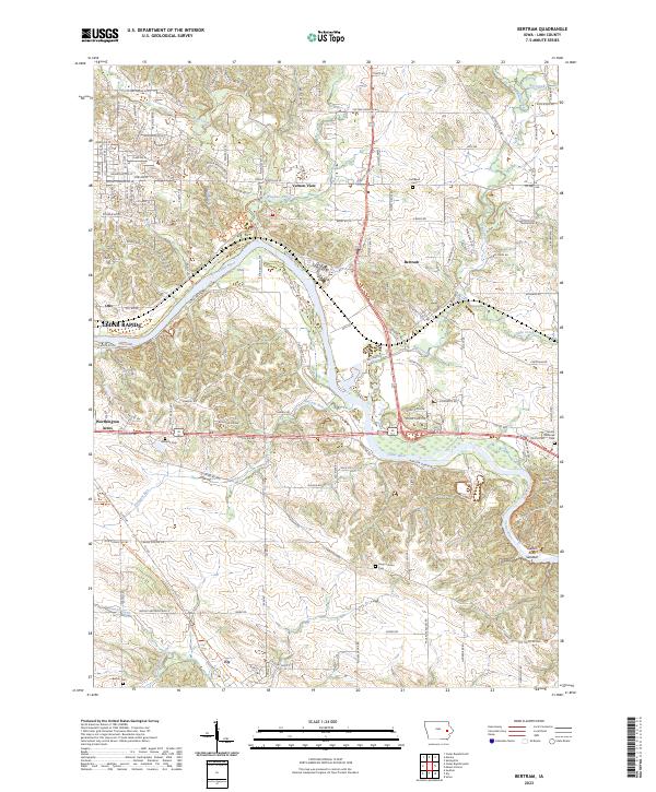
2023 Map of Bertram
USGS Topo · Published 2023About this map
The Cedar River carves a winding path through this portion of Linn County, shaping a landscape defined by significant watercourse confluences and modern transportation corridors. The settlement of Bertram sits near the junction where Big Creek and Abbe Creek meet the river, while further west, the suburban expansion of Cedar Rapids is evident through residential developments like Vernon View and Worthington Acres. The map reveals a mix of recreational and historical layers, with the Hoover Nature Trail and Sac & Fox Trail tracing older land-use patterns across the terrain. Genealogists will find several burial sites preserved amidst the shifting land use, including Campbell Cem, Williams Cem, and Rogers Grove Cem. This contemporary survey also highlights distinctive river features such as the Cedar River Sandbar and several small tributaries like Indian Creek and Wanatee Creek that feed into the primary river valley.
Find a feature on this map
58 named features on this map. Tap any name to fly to it.
Don’t see what you’re looking for? This feature index may not catch every label — zoom into the map to look around manually.
Map Details
Editions of this 2023 Bertram Map
This is the sole edition of this map. No revisions or reprints were ever made.
Other maps of this area

1887 · Cedar Rapids
USGS Topo · 1:62,500

1888 · Marion
USGS Topo · 1:62,500

1889 · Marion
USGS Topo · 1:62,500

1890 · Anamosa
USGS Topo · 1:62,500

1891 · Mechanicsville
USGS Topo · 1:62,500

1891 · Cedar Rapids
USGS Topo · 1:62,500

1894 · Mechanicsville
USGS Topo · 1:62,500

1900 · Anamosa
USGS Topo · 1:125,000

1901 · Stanwood
USGS Topo · 1:125,000

1903 · Fairfax
USGS Topo · 1:125,000