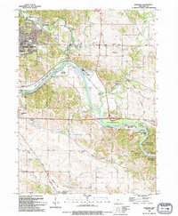
1993 Map of Bertram
USGS Topo · Published 1994About this map
The Cedar River carves a deep valley through this portion of Linn County, shaping the settlement patterns of Cedar Rapids and the village of Bertram. By the early 1990s, the urban edge of Cedar Rapids is visible near Pioneer Park, while the surrounding landscape remains largely agricultural and interspersed with significant recreational spaces like Palisades-Kepler State Park and Squaw Creek County Park. Transport corridors such as Wright Brothers Blvd and an Old Railroad Grade illustrate the region's movement from early rail dependence to modern automotive infrastructure.
Find a feature on this map
42 named features on this map. Tap any name to fly to it.
Don’t see what you’re looking for? This feature index may not catch every label — zoom into the map to look around manually.
Map Details
Editions of this 1993 Bertram Map
This is the sole edition of this map. No revisions or reprints were ever made.
Other maps of this area

1887 · Cedar Rapids
USGS Topo · 1:62,500

1888 · Marion
USGS Topo · 1:62,500

1889 · Marion
USGS Topo · 1:62,500

1890 · Anamosa
USGS Topo · 1:62,500

1891 · Mechanicsville
USGS Topo · 1:62,500

1891 · Cedar Rapids
USGS Topo · 1:62,500

1894 · Mechanicsville
USGS Topo · 1:62,500

1900 · Anamosa
USGS Topo · 1:125,000

1901 · Stanwood
USGS Topo · 1:125,000

1903 · Fairfax
USGS Topo · 1:125,000