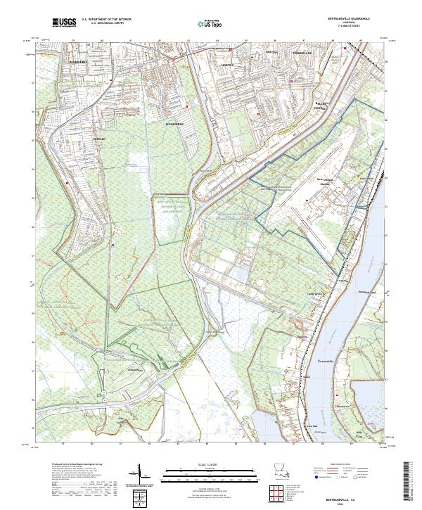
2024 Map of Bertrandville
USGS Topo · Published 2024About this map
The Mississippi River creates a sharp natural boundary for this section of Plaquemines and Jefferson Parishes, where the low-lying wetlands of the Jean Lafitte National Historical Park and Preserve meet the industrial and military infrastructure of the contemporary South. The landscape is defined by its hydraulic engineering, including the Intracoastal Waterway, Hero Cutoff, and numerous drainage channels like Sarah Canal and Augusta Canal. This network of water sustains a series of linear settlements along the river's western bank, including Bertrandville, Oakville, and Cedar Grove. The interior is dominated by the sprawling Naval Air Station Joint Reserve Base New Orleans and its associated Alvin Callender Field, illustrating the strategic maritime and aerial importance of this region south of the metropolitan center.
Find a feature on this map
59 named features on this map. Tap any name to fly to it.
Don’t see what you’re looking for? This feature index may not catch every label — zoom into the map to look around manually.
Map Details
Editions of this 2024 Bertrandville Map
This is the sole edition of this map. No revisions or reprints were ever made.
Other maps of this area

1891 · Pointe a La Hache
USGS Topo · 1:62,500

1891 · New Orleans
USGS Topo · 1:62,500

1892 · Barataria
USGS Topo · 1:62,500

1892 · St. Bernard
USGS Topo · 1:62,500

1892 · Pointe a La Hache
USGS Topo · 1:62,500

1932 · New Orleans NE
USGS Topo · 1:31,680

1932 · New Orleans NW
USGS Topo · 1:31,680

1932 · New Orleans SE
USGS Topo · 1:31,680

1932 · New Orleans SW
USGS Topo · 1:31,680
1938 · New Orleans West
USGS Topo · 1:31,680