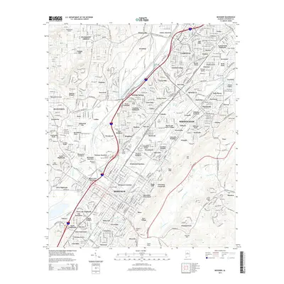
2014 Map of Bessemer
USGS Topo · Published 2014About this map
Jones Valley and the surrounding ridges of Red Mtn and Little Shades Mtn anchor this portrait of Alabama's industrial heartland. The dense network of communities including Brighton, Pleasant Grove, and Hueytown reflects the area's legacy of labor and proximity to the mineral wealth of the surrounding hills. This survey records the complex neighborhood patterns formed around historical junctions like Bessemer Junction, Dolonar Junction, and Woodward Junction, which served the massive local industrial operations. For those tracing family history, the map identifies numerous resting places such as Oakland Cem, Union Cem, and Cedar Hill Cem. The terrain is deeply carved by waterways like Valley Cr and Opossum Cr, which define the topography between the sprawling residential districts and the massive industrial corridors of Bessemer and Birmingham.
Find a feature on this map
137 named features on this map. Tap any name to fly to it.
Don’t see what you’re looking for? This feature index may not catch every label — zoom into the map to look around manually.
Map Details
Editions of this 2014 Bessemer Map
This is the sole edition of this map. No revisions or reprints were ever made.
Other maps of this area

1889 · Birmingham
USGS Topo · 1:125,000

1890 · Bessemer
USGS Topo · 1:125,000

1892 · Birmingham
USGS Topo · 1:125,000

1892 · Bessemer
USGS Topo · 1:125,000

1893 · Jasper
USGS Topo · 1:125,000

1895 · Birmingham
USGS Topo · 1:125,000

1899 · Brookwood
USGS Topo · 1:125,000

1904 · Birmingham Coal District
USGS Topo · 1:62,500

1905 · Bessemer Iron District
USGS Topo · 1:62,500

1906 · Birmingham Special
USGS Topo · 1:62,500