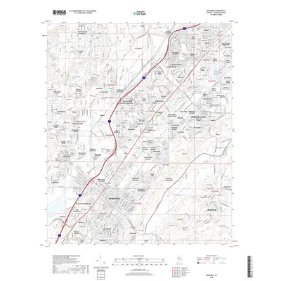
2018 Map of Bessemer
USGS Topo · Published 2018About this map
Industrial and residential development defines this Jefferson County landscape, where the long ridge of Red Mtn overlooks a dense network of neighborhoods and industrial sites. The map documents the sprawling urban footprint of Fairfield and Hueytown, alongside specialized locales like Interurban Heights and Industrial City. Educational institutions including Miles College and the Lawson State Community College-Birmingham Campus are established fixtures within the built environment.
Find a feature on this map
125 named features on this map. Tap any name to fly to it.
Don’t see what you’re looking for? This feature index may not catch every label — zoom into the map to look around manually.
Map Details
Editions of this 2018 Bessemer Map
This is the sole edition of this map. No revisions or reprints were ever made.
Other maps of this area

1889 · Birmingham
USGS Topo · 1:125,000

1890 · Bessemer
USGS Topo · 1:125,000

1892 · Birmingham
USGS Topo · 1:125,000

1892 · Bessemer
USGS Topo · 1:125,000

1893 · Jasper
USGS Topo · 1:125,000

1895 · Birmingham
USGS Topo · 1:125,000

1899 · Brookwood
USGS Topo · 1:125,000

1904 · Birmingham Coal District
USGS Topo · 1:62,500

1905 · Bessemer Iron District
USGS Topo · 1:62,500

1906 · Birmingham Special
USGS Topo · 1:62,500