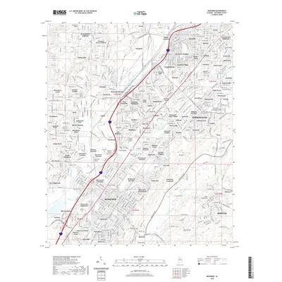
2020 Map of Bessemer
USGS Topo · Published 2020About this map
Fairfield and the industrial suburbs west of Birmingham are deeply interconnected by the Birmingham Southern RR and an extensive grid of residential neighborhoods. This area, historically defined by the steel industry, is home to institutional landmarks like Miles College and the Lawson State Community College Birmingham Campus. The map reveals a dense settlement pattern that includes communities such as Dolomite, Westfield, and Ensley Junction, interspersed with significant cemeteries like Oakland Cem and Mason Cem. The terrain is marked by the distinct ridges of West Red Mtn and Muscoda Mtn, with Valley Creek and Opossum Cr draining the industrial valleys. Modern infrastructure is represented by the Alabama Adventure Pkwy and Allison Bonnett Memorial Dr, which cut through established areas like Hueytown Crest and Pleasant Grove Estates.
Find a feature on this map
134 named features on this map. Tap any name to fly to it.
Don’t see what you’re looking for? This feature index may not catch every label — zoom into the map to look around manually.
Map Details
Editions of this 2020 Bessemer Map
This is the sole edition of this map. No revisions or reprints were ever made.
Other maps of this area

1889 · Birmingham
USGS Topo · 1:125,000

1890 · Bessemer
USGS Topo · 1:125,000

1892 · Birmingham
USGS Topo · 1:125,000

1892 · Bessemer
USGS Topo · 1:125,000

1893 · Jasper
USGS Topo · 1:125,000

1895 · Birmingham
USGS Topo · 1:125,000

1899 · Brookwood
USGS Topo · 1:125,000

1904 · Birmingham Coal District
USGS Topo · 1:62,500

1905 · Bessemer Iron District
USGS Topo · 1:62,500

1906 · Birmingham Special
USGS Topo · 1:62,500