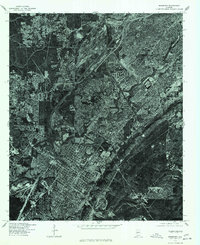
1975 Map of Bessemer
USGS Topo · Published 1977About this map
Bessemer and the southwestern industrial fringes of Birmingham are captured in this mid-1970s orthophotoquad, which uses rectified aerial imagery to show the dense urban and industrial development of Jefferson County. The high-contrast imagery highlights the concentrated grid of Bessemer in the lower portion of the sheet, while the northern sections show the growing residential patterns of Pleasant Grove and Hueytown. Unlike a traditional topographic map, this photographic survey reveals the actual physical density of the region's steel-era infrastructure, including large-scale industrial complexes and the intricate web of rail yards and transport corridors that connected these major Alabama centers during a period of significant urban evolution.
Find a feature on this map
4 named features on this map. Tap any name to fly to it.
Don’t see what you’re looking for? This feature index may not catch every label — zoom into the map to look around manually.
Map Details
Editions of this 1975 Bessemer Map
This is the sole edition of this map. No revisions or reprints were ever made.
Other maps of this area

1889 · Birmingham
USGS Topo · 1:125,000

1890 · Bessemer
USGS Topo · 1:125,000

1892 · Birmingham
USGS Topo · 1:125,000

1892 · Bessemer
USGS Topo · 1:125,000

1893 · Jasper
USGS Topo · 1:125,000

1895 · Birmingham
USGS Topo · 1:125,000

1899 · Brookwood
USGS Topo · 1:125,000

1904 · Birmingham Coal District
USGS Topo · 1:62,500

1905 · Bessemer Iron District
USGS Topo · 1:62,500

1906 · Birmingham Special
USGS Topo · 1:62,500