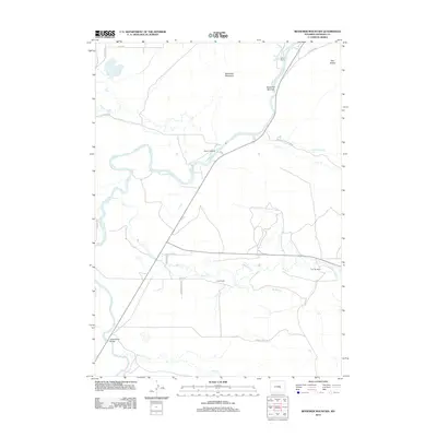
2012 Map of Bessemer Mountain
USGS Topo · Published 2012About this map
The N Platte River anchors this central Wyoming landscape, winding through a complex of historic ranch lands and topographical bottlenecks. The river passes through the Bessemer Narrows at the foot of Bessemer Mountain, a site defined by its dramatic relief and strategic position along the water. In the early 21st century, this area remains characterized by traditional livestock operations including the Speas Ranch, Clark Ranch, and Two Bar Ranch, which follow the fertile valleys of tributaries like Bates Cr and Stinking Cr. Historic points of passage across the river are clearly identified, such as the Winter Crossing and Government Bridge to the south. Other prominent natural landmarks include the Red Buttes in the northeast and the waters of Goose Egg Spring, illustrating the importance of natural water sources in this arid ranching corridor.
Find a feature on this map
28 named features on this map. Tap any name to fly to it.
Don’t see what you’re looking for? This feature index may not catch every label — zoom into the map to look around manually.
Map Details
Editions of this 2012 Bessemer Mountain Map
This is the sole edition of this map. No revisions or reprints were ever made.
Other maps of this area

1950 · Emigrant Gap
USGS Topo · 1:24,000

1950 · Goose Egg
USGS Topo · 1:24,000

1950 · Alcova SE
USGS Topo · 1:24,000

1950 · Alcova
USGS Topo · 1:24,000

1951 · Oil Mountain
USGS Topo · 1:24,000

1951 · Clarkson Hill
USGS Topo · 1:24,000

1951 · Bessemer Mountain
USGS Topo · 1:24,000

1955 · Casper
USGS Topo · 1:250,000

1958 · Casper
USGS Topo · 1:250,000
1960 · Emigrant Gap
USGS Topo · 1:24,000