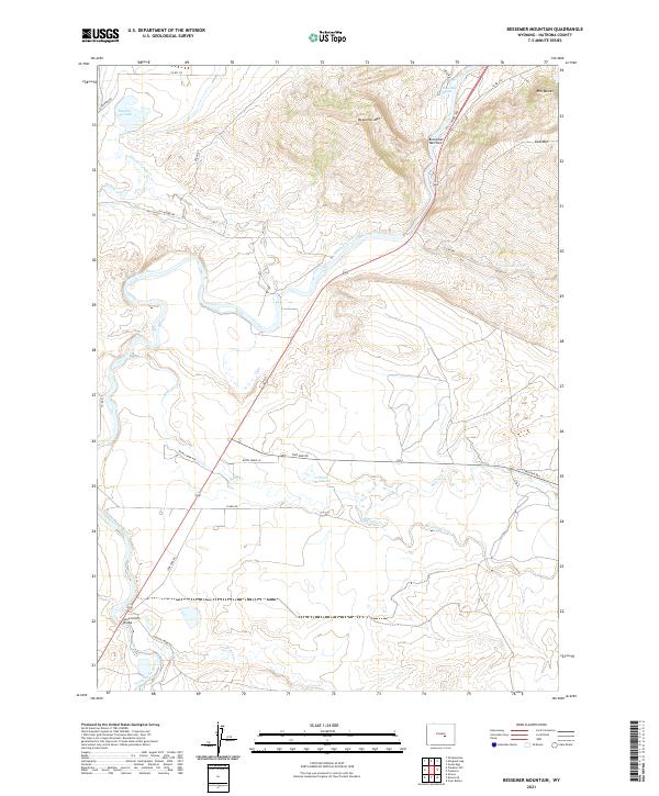
2021 Map of Bessemer Mountain
USGS Topo · Published 2021About this map
The North Platte River winds through the heart of this Natrona County landscape, carving a dramatic path through the Bessemer Narrows beneath the rising slopes of Bessemer Mtn. This modern survey details a region where water management and topography dictate the land use, from the high desert terrain of Coal Mtn and Red Buttes to the essential water sources of O'Brien Reservoir and Rasmus Lee Lake. Historical infrastructure is represented by the crossing at Government Bridge in the southwestern corner, a vital link across the river. The map also documents a network of rural routes and watercourses, including the curiously named Stinking Creek and the historical corridor along the Bates Creek Rte. Small springs like Goose Egg Spring remain noted landmarks in this arid environment, serving as traditional waypoints for local travel.
Find a feature on this map
37 named features on this map. Tap any name to fly to it.
Don’t see what you’re looking for? This feature index may not catch every label — zoom into the map to look around manually.
Map Details
Editions of this 2021 Bessemer Mountain Map
This is the sole edition of this map. No revisions or reprints were ever made.
Other maps of this area

1950 · Emigrant Gap
USGS Topo · 1:24,000

1950 · Goose Egg
USGS Topo · 1:24,000

1950 · Alcova SE
USGS Topo · 1:24,000

1950 · Alcova
USGS Topo · 1:24,000

1951 · Oil Mountain
USGS Topo · 1:24,000

1951 · Clarkson Hill
USGS Topo · 1:24,000

1951 · Bessemer Mountain
USGS Topo · 1:24,000

1955 · Casper
USGS Topo · 1:250,000

1958 · Casper
USGS Topo · 1:250,000
1960 · Emigrant Gap
USGS Topo · 1:24,000