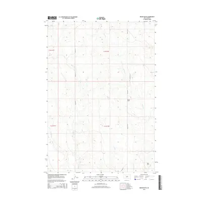
2015 Map of Bessie Butte
USGS Topo · Published 2015About this map
Bessie Butte and Mud Butte dominate the landscape of Ziebach County in this 2015 survey, serving as prominent landmarks in the high plains of South Dakota. The area is defined by a dendritic drainage network, where seasonal waterways like Red Coat Cr and Butcher Cr have carved the terrain into a complex series of ridges and draws. These creeks, along with Mud Cr and Red Scaffold Cr, illustrate the subtle but significant elevation changes across the township. Human infrastructure is limited to a sparse grid of section-line roads, notably Bachman Rd and Arrow Head Rd, which provide access through this remote ranching and grazing country. The map highlights the intersection of public land survey systems across T11N and T12N, reflecting the geometric organization of the American West.
Find a feature on this map
13 named features on this map. Tap any name to fly to it.
Don’t see what you’re looking for? This feature index may not catch every label — zoom into the map to look around manually.
Map Details
Editions of this 2015 Bessie Butte Map
This is the sole edition of this map. No revisions or reprints were ever made.
Other maps of this area

1953 · Rapid City
USGS Topo · 1:250,000

1953 · McIntosh
USGS Topo · 1:250,000

1954 · Lemmon
USGS Topo · 1:250,000

1954 · Pierre
USGS Topo · 1:250,000

1957 · Lemmon
USGS Topo · 1:250,000

1957 · Rapid City
USGS Topo · 1:250,000

1958 · Pierre
USGS Topo · 1:250,000

1958 · McIntosh
USGS Topo · 1:250,000

1982 · Chasing Hawk Draw
USGS Topo · 1:24,000

1982 · Bull Creek 2 NE
USGS Topo · 1:24,000