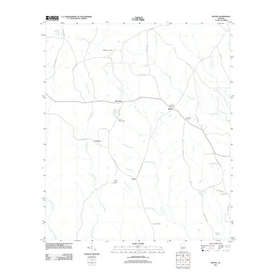
2011 Map of Bethel
USGS Topo · Published 2011About this map
Mixonville and Bethel serve as the primary focal points of this settlement pattern in south-central Alabama, where small communities are interconnected by a network of county roads. The landscape is defined by the drainage systems of the East Sepulga River and Duck Creek, which carve through the terrain and dictate the placement of early homes and small farms. This survey provides a vital geographic record for family historians, documenting numerous burial grounds including Middleton Cemetery, Old Bethel Cemetery, and Concord Cemetery.
Find a feature on this map
36 named features on this map. Tap any name to fly to it.
Don’t see what you’re looking for? This feature index may not catch every label — zoom into the map to look around manually.
Map Details
Editions of this 2011 Bethel Map
This is the sole edition of this map. No revisions or reprints were ever made.
Other maps of this area

1953 · Andalusia
USGS Topo · 1:250,000

1957 · Andalusia
USGS Topo · 1:250,000

1971 · Lyeffion
USGS Topo · 1:24,000

1971 · Garland
USGS Topo · 1:24,000

1971 · Skinnerton
USGS Topo · 1:24,000

1971 · China
USGS Topo · 1:24,000

1971 · Bethel
USGS Topo · 1:24,000

1971 · Georgiana West
USGS Topo · 1:24,000

1981 · Forest Home
USGS Topo · 1:24,000
1981 · Mc Williams
USGS Topo · 1:24,000