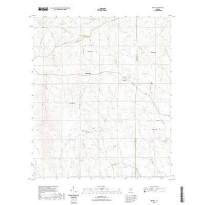
2020 Map of Bethel
USGS Topo · Published 2020About this map
Commerce and Bethel sit at the center of this rural South Alabama landscape, where the headwaters of the E Sepulga River and W Sepulga River drain the rolling countryside. This 2020 survey highlights a network of historic transportation routes, most notably the Old Federal Rd cutting across the northern boundary, a legacy of early 19th-century migration. Small communities like Mixonville and Deans are defined by their proximity to local watercourses such as Duck Cr and Pigett Mill Cr. Genealogists will find significant value in the distribution of family and community burial grounds, including Middleton Cem, Concord Cem, and both the Bethel West Cem and Old Bethel Cem. The map provides a contemporary view of these long-established settlements within the shifting timber and agricultural lands of Conecuh, Monroe, and Butler counties.
Find a feature on this map
52 named features on this map. Tap any name to fly to it.
Don’t see what you’re looking for? This feature index may not catch every label — zoom into the map to look around manually.
Map Details
Editions of this 2020 Bethel Map
This is the sole edition of this map. No revisions or reprints were ever made.
Other maps of this area

1953 · Andalusia
USGS Topo · 1:250,000

1957 · Andalusia
USGS Topo · 1:250,000

1971 · Lyeffion
USGS Topo · 1:24,000

1971 · Garland
USGS Topo · 1:24,000

1971 · Skinnerton
USGS Topo · 1:24,000

1971 · China
USGS Topo · 1:24,000

1971 · Bethel
USGS Topo · 1:24,000

1971 · Georgiana West
USGS Topo · 1:24,000

1981 · Forest Home
USGS Topo · 1:24,000
1981 · Mc Williams
USGS Topo · 1:24,000