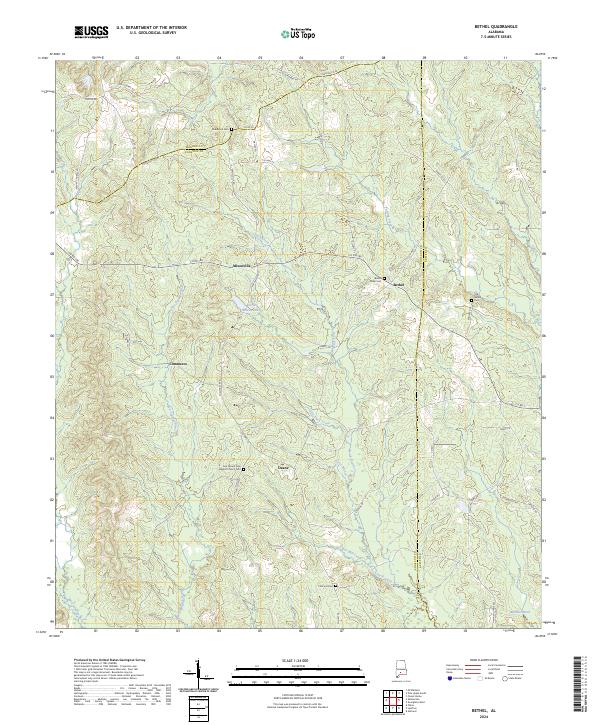
2024 Map of Bethel
USGS Topo · Published 2024About this map
The Old Federal Rd cuts through the northern timberlands of this Alabama landscape, tracing a historic transit corridor that predates modern statehood. The settlement of Bethel serves as a local anchor, flanked by its spiritual and ancestral markers at Bethel West Cem and Old Bethel Cem. This rural survey highlights a territory defined by its watercourses, where the East Sepulga River and West Sepulga River drain the southern reaches. Small crossroads communities like Mixonville, near Alvin Mixon Lake, and Commerce reflect the persistent, dispersed settlement patterns of Conecuh County. Genealogists will find significant value in the distribution of family and community landmarks, from Deans to the First Mount Zion Baptist Church, alongside several smaller burial grounds including Middleton Cem and Concord Cem scattered across the township lines.
Find a feature on this map
50 named features on this map. Tap any name to fly to it.
Don’t see what you’re looking for? This feature index may not catch every label — zoom into the map to look around manually.
Map Details
Editions of this 2024 Bethel Map
This is the sole edition of this map. No revisions or reprints were ever made.
Other maps of this area

1953 · Andalusia
USGS Topo · 1:250,000

1957 · Andalusia
USGS Topo · 1:250,000

1971 · Lyeffion
USGS Topo · 1:24,000

1971 · Garland
USGS Topo · 1:24,000

1971 · Skinnerton
USGS Topo · 1:24,000

1971 · China
USGS Topo · 1:24,000

1971 · Bethel
USGS Topo · 1:24,000

1971 · Georgiana West
USGS Topo · 1:24,000

1981 · Forest Home
USGS Topo · 1:24,000
1981 · Mc Williams
USGS Topo · 1:24,000