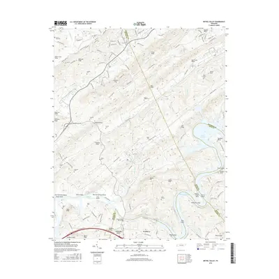
2016 Map of Bethel Valley
USGS Topo · Published 2016About this map
Melton Hill Lake and the winding course of the Clinch River define this East Tennessee landscape, where the ridges of Chestnut Ridge and Copper Ridge run in parallel formation. The map reveals a complex intersection of county lines where Anderson, Roane, Knox, and Loudon counties converge near Lenoir City. While residential streets like Wisconsin Ave and Oklahoma Ave cluster in the north, much of the terrain is characterized by the long, wooded profiles of Blackoak Ridge and Haw Ridge. Researchers will find numerous family burial grounds and small community sites, such as Hembree Cem, Currier Cem, and Scott Cem, often located on higher ground above the river valleys. The Charles Vanden Bulck Bridge spans the water near Bradbury Valley, marking a vital transit point in this valley-and-ridge system.
Find a feature on this map
130 named features on this map. Tap any name to fly to it.
Don’t see what you’re looking for? This feature index may not catch every label — zoom into the map to look around manually.
Map Details
Editions of this 2016 Bethel Valley Map
This is the sole edition of this map. No revisions or reprints were ever made.
Other maps of this area

1893 · Briceville
USGS Topo · 1:125,000

1895 · Loudon
USGS Topo · 1:125,000

1895 · Briceville
USGS Topo · 1:125,000

1896 · Briceville
USGS Topo · 1:125,000

1935 · Lenoir City
USGS Topo · 1:24,000

1935 · Elverton
USGS Topo · 1:24,000

1935 · Bethel Valley
USGS Topo · 1:24,000

1935 · Lovell
USGS Topo · 1:24,000

1936 · Cave Creek
USGS Topo · 1:24,000

1936 · Windrock
USGS Topo · 1:24,000