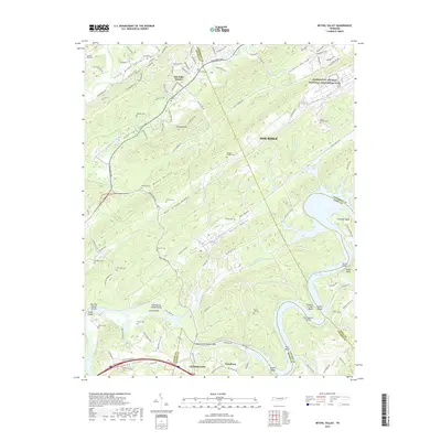
2019 Map of Bethel Valley
USGS Topo · Published 2019About this map
The Manhattan Project National Historical Park anchors the northeast corner of this landscape, reflecting the unique scientific and defense legacy of Oak Ridge. The area is defined by its ridge-and-valley topography, with the Clinch River's presence felt through the waters of Melton Hill Lake and a series of distinct geographic features like Bethel Valley and Bear Creek Valley. The terrain is marked by numerous family and community burial grounds, including the New Zion Cem, Gravel Hill Cem, and Thacker Cem, which offer significant data points for genealogists. To the south, the settlement of Lenoir City sits near the Charles Vanden Bulck Bridge, illustrating the modern transportation network that has superseded older crossings. Along the river, named shoals like Hops Shoals and Bogles Shoals remain as markers of the waterway's character before the creation of the reservoir.
Find a feature on this map
90 named features on this map. Tap any name to fly to it.
Don’t see what you’re looking for? This feature index may not catch every label — zoom into the map to look around manually.
Map Details
Editions of this 2019 Bethel Valley Map
This is the sole edition of this map. No revisions or reprints were ever made.
Other maps of this area

1893 · Briceville
USGS Topo · 1:125,000

1895 · Loudon
USGS Topo · 1:125,000

1895 · Briceville
USGS Topo · 1:125,000

1896 · Briceville
USGS Topo · 1:125,000

1935 · Lenoir City
USGS Topo · 1:24,000

1935 · Elverton
USGS Topo · 1:24,000

1935 · Bethel Valley
USGS Topo · 1:24,000

1935 · Lovell
USGS Topo · 1:24,000

1936 · Cave Creek
USGS Topo · 1:24,000

1936 · Windrock
USGS Topo · 1:24,000