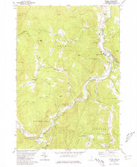
1980 Map of Bethel
USGS Topo · Published 1981About this map
The White River carves a deep valley through the Green Mountains in this late twentieth-century survey, anchoring a landscape of small settlements and high peaks. The village of Bethel serves as a local hub where the Central Vermont railroad tracks follow the river's curve, passing near the Whitcomb High Sch and a local Drive-In Theater. Downstream, the White River National Fish Hatchery occupies a bend in the water near Gaysville, a community marked by its historic riverfront orientation.
Find a feature on this map
53 named features on this map. Tap any name to fly to it.
Don’t see what you’re looking for? This feature index may not catch every label — zoom into the map to look around manually.
Map Details
Editions of this 1980 Bethel Map
3 editions found
Other maps of this area

1891 · Rutland
USGS Topo · 1:62,500

1893 · Rutland
USGS Topo · 1:62,500

1911 · Woodstock
USGS Topo · 1:62,500

1913 · Woodstock
USGS Topo · 1:62,500

1915 · Rochester
USGS Topo · 1:62,500

1917 · Rochester
USGS Topo · 1:62,500

1919 · Royalton
USGS Topo · 1:62,500

1924 · Randolph
USGS Topo · 1:48,000

1926 · Randolph
USGS Topo · 1:62,500

1943 · Woodstock
USGS Topo · 1:62,500