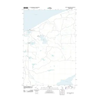
2011 Map of Betsy Lake North
USGS Topo · Published 2011About this map
The southern shoreline of Lake Superior meets the thick forests of Luce County in this early 21st-century landscape. The area is defined by its water-access infrastructure, including the State Waterways Commission Dock and several recreational outposts such as Chippewa Lodge and Seminole Lodge. Further inland, the map details a network of interior lakes and drainage systems, including Bodi Lake and Culhane Lake, both of which support dedicated forest campgrounds. These interior waters feed into prominent coastal features like the Little Two Hearted River and Threemile Creek. The road network is sparse, centered on routes like Crisp Point Rd and County Rd 500, which provide the primary access to these remote northern Michigan campsites and fishing grounds. The map's detail provides a clear view of the wetland margins surrounding Parcell Lakes and Betsy Lake, illustrating the complex hydrology of the Upper Peninsula.
Find a feature on this map
26 named features on this map. Tap any name to fly to it.
Don’t see what you’re looking for? This feature index may not catch every label — zoom into the map to look around manually.
Map Details
Editions of this 2011 Betsy Lake North Map
This is the sole edition of this map. No revisions or reprints were ever made.
Other maps of this area

1951 · Vermilion
USGS Topo · 1:24,000

1951 · Sheephead Lake
USGS Topo · 1:24,000

1951 · Timberlost
USGS Topo · 1:24,000

1951 · Shelldrake
USGS Topo · 1:62,500

1954 · Sault Sainte Marie
USGS Topo · 1:250,000

1956 · Sault Sainte Marie
USGS Topo · 1:250,000

1957 · Sault Sainte Marie
USGS Topo · 1:250,000

1958 · Sault Sainte Marie
USGS Topo · 1:250,000
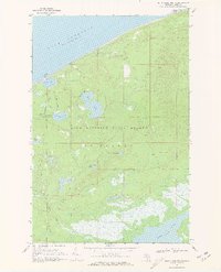
1968 · Betsy Lake North
USGS Topo · 1:24,000

1968 · Betsy Lake NW
USGS Topo · 1:24,000