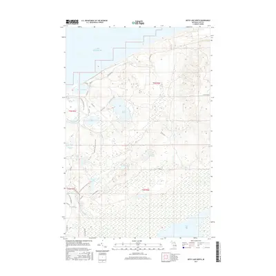
2017 Map of Betsy Lake North
USGS Topo · Published 2017About this map
Lake Superior shorelines and the secluded interior of Luce County define this remote coastal area. This 2017 survey documents a landscape dominated by water and trails, featuring the N Country National Scenic Trail as it winds through the northern forest past Little Lake Harbor. The map reveals a complex network of glacial lakes, including the sizable Bodi Lake and Culhane Lake, which feed the local river systems. To the east, the Two Hearted River flows toward the coast, while the northern boundary is marked by the mouth of the Carp River. Transportation is limited to a few primary arteries like Crisp Point Rd and Northwestern Rd, indicating a terrain preserved for its natural character rather than industrial or residential development. Notable landmarks such as the Betsy Tower Rd and Section Five Lake highlight the low-lying, wetland-rich environment near the northern edge of the Upper Peninsula.
Find a feature on this map
36 named features on this map. Tap any name to fly to it.
Don’t see what you’re looking for? This feature index may not catch every label — zoom into the map to look around manually.
Map Details
Editions of this 2017 Betsy Lake North Map
This is the sole edition of this map. No revisions or reprints were ever made.
Other maps of this area

1951 · Vermilion
USGS Topo · 1:24,000

1951 · Sheephead Lake
USGS Topo · 1:24,000

1951 · Timberlost
USGS Topo · 1:24,000

1951 · Shelldrake
USGS Topo · 1:62,500

1954 · Sault Sainte Marie
USGS Topo · 1:250,000

1956 · Sault Sainte Marie
USGS Topo · 1:250,000

1957 · Sault Sainte Marie
USGS Topo · 1:250,000

1958 · Sault Sainte Marie
USGS Topo · 1:250,000
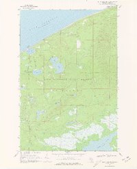
1968 · Betsy Lake North
USGS Topo · 1:24,000

1968 · Betsy Lake NW
USGS Topo · 1:24,000