
2011 Map of Betsy Lake North OE N
USGS Topo · Published 2011About this map
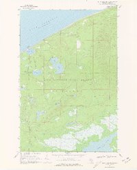
Lake Superior dominates this nautical landscape along the Upper Peninsula's northern coastline. The survey focuses on a remote stretch of the Luce County shore, where the primary landmark is the Crisp Point Lighthouse situated at Crisp Point. This 2011 rendering shows the isolation of the maritime facility, with Crisp Point Rd providing the only terrestrial access to the point. The map is primarily an expanse of open water, illustrating the navigational context for one of the region's historical lake superior aids to navigation. It provides a clear view of the immediate topography and shoreline configuration surrounding the light station during the early 21st century.
Find a feature on this map
4 named features on this map. Tap any name to fly to it.
Don’t see what you’re looking for? This feature index may not catch every label — zoom into the map to look around manually.
Map Details
Editions of this 2011 Betsy Lake North OE N Map
This is the sole edition of this map. No revisions or reprints were ever made.
Other maps of this area

1951 · Vermilion
USGS Topo · 1:24,000

1951 · Sheephead Lake
USGS Topo · 1:24,000

1951 · Shelldrake
USGS Topo · 1:62,500

1954 · Sault Sainte Marie
USGS Topo · 1:250,000

1956 · Sault Sainte Marie
USGS Topo · 1:250,000

1957 · Sault Sainte Marie
USGS Topo · 1:250,000

1958 · Sault Sainte Marie
USGS Topo · 1:250,000
1968 · Betsy Lake North
USGS Topo · 1:24,000

1968 · Betsy Lake NW
USGS Topo · 1:24,000
1985 · Two Hearted River
USGS Topo · 1:100,000