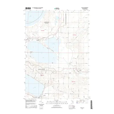
2014 Map of Beulah
USGS Topo · Published 2014About this map
Sleeping Bear Dunes National Lakeshore dominates the northern reaches of this Benzie County landscape, where the shifting topography meets the waters of Lake Michigan. The map reveals a dense concentration of glacial lakes, including the expansive Crystal Lake and the interconnected Platte Lake and Little Platte Lake. The settlement pattern centers on the village of Beulah and neighboring Benzonia, which sit at the southeastern tip of Crystal Lake, while the town of Honor lies further east along the Platte River. The interior is crisscrossed by established thoroughfares like the Northland Hwy and more localized routes such as Deadstream Rd and Gudemoos Rd. Notable landmarks for local history include Champion Hill Cem and smaller landings and points such as Edgewater, Birch Point, and Bay Point, providing a precise look at Michigan's northwestern lakeshore during the early 21st century.
Find a feature on this map
95 named features on this map. Tap any name to fly to it.
Don’t see what you’re looking for? This feature index may not catch every label — zoom into the map to look around manually.
Map Details
Editions of this 2014 Beulah Map
This is the sole edition of this map. No revisions or reprints were ever made.
Other maps of this area

1954 · Traverse City
USGS Topo · 1:250,000

1954 · Manitowoc
USGS Topo · 1:250,000

1956 · Thompsonville
USGS Topo · 1:62,500

1956 · Frankfort
USGS Topo · 1:62,500

1957 · Empire
USGS Topo · 1:62,500

1957 · Maple City
USGS Topo · 1:62,500

1958 · Traverse City
USGS Topo · 1:250,000

1958 · Manitowoc
USGS Topo · 1:250,000

1976 · Frankfort SE
USGS Topo · 1:24,000

1976 · Frankfort NW
USGS Topo · 1:24,000