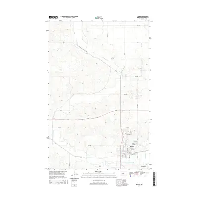
2014 Map of Beulah
USGS Topo · Published 2014About this map
Beulah serves as the focal point of this North Dakota landscape, where the confluence of regional transit and natural waterways shaped the town's development. The residential and commercial streets are densely clustered north of the Knife River, with local landmarks like Beulah Airport and the waters of Wally Dresskell Lake marking the southern edge of town. The area’s energy history is represented by the Williston Basin feature at the southeastern corner, reflecting the industrial character of Mercer County.
Find a feature on this map
36 named features on this map. Tap any name to fly to it.
Don’t see what you’re looking for? This feature index may not catch every label — zoom into the map to look around manually.
Map Details
Editions of this 2014 Beulah Map
This is the sole edition of this map. No revisions or reprints were ever made.
Other maps of this area

1954 · McClusky
USGS Topo · 1:250,000

1958 · McClusky
USGS Topo · 1:250,000

1968 · Beulah
USGS Topo · 1:24,000

1968 · Medicine Butte NE
USGS Topo · 1:24,000

1968 · Red Butte NW
USGS Topo · 1:24,000

1968 · Hazen West
USGS Topo · 1:24,000

1968 · Medicine Butte
USGS Topo · 1:24,000

1969 · Beulah NE
USGS Topo · 1:24,000
1969 · Hazen NW
USGS Topo · 1:24,000
1969 · Beulah NW
USGS Topo · 1:24,000