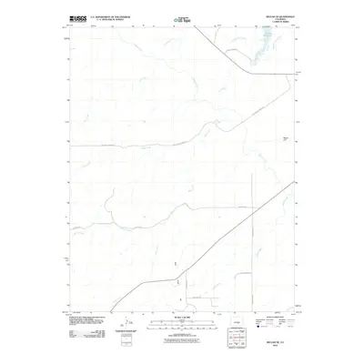
2010 Map of Beulah NE
USGS Topo · Published 2010About this map
The Pueblo Reservoir dominates the northeastern corner of this landscape, its western waters extending into the protected lands of Pueblo State Park. This region is defined by a sophisticated water management network, where the Arkansas Valley Conduit and the long, winding Minnequa Canal trace the contours of the terrain to divert precious resources across the semi-arid plains. The landscape transitions from the flat expanse of Boggs Flat to a series of drainage basins including Peck Creek, Rock Creek, and Soda Creek. These waterways and their accompanying access routes, such as Red Creek Springs Rd and Galbreth Rd, illustrate the sparse but deliberate footprint of ranching and utility infrastructure in this part of Pueblo County.
Find a feature on this map
18 named features on this map. Tap any name to fly to it.
Don’t see what you’re looking for? This feature index may not catch every label — zoom into the map to look around manually.
Map Details
Editions of this 2010 Beulah NE Map
This is the sole edition of this map. No revisions or reprints were ever made.
Other maps of this area

1891 · Pueblo
USGS Topo · 1:125,000

1894 · Pueblo
USGS Topo · 1:125,000

1896 · Pueblo
USGS Topo · 1:125,000

1897 · Pueblo
USGS Topo · 1:125,000

1954 · Pueblo
USGS Topo · 1:250,000

1957 · Pueblo
USGS Topo · 1:250,000

1958 · Pueblo
USGS Topo · 1:250,000

1961 · Northwest Pueblo
USGS Topo · 1:24,000

1961 · Southwest Pueblo
USGS Topo · 1:24,000

1962 · Pueblo
USGS Topo · 1:250,000