1961 Map of Southwest Pueblo
USGS Topo · Published 1963About this map
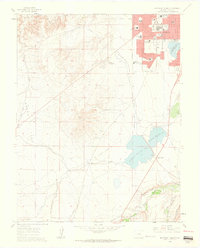
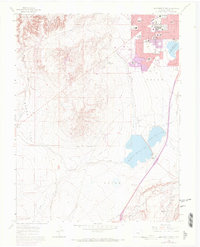
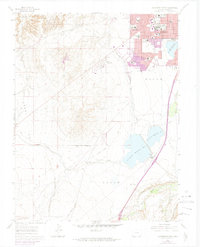
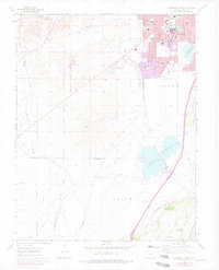
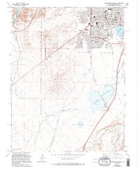
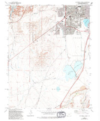
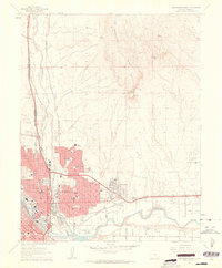
Pueblo's southwestern expansion is recorded here during a period of mid-century growth, showing the transition from the organized city grid to the open terrain of Boggs Flat. The map highlights the city's social and industrial infrastructure, featuring the State Fairgrounds and an extensive network of schools including South High School and Corwin Junior High. Beyond the suburban reach of Beulah Heights, the landscape is defined by its water management systems, notably the Arkansas Valley Conduit and the sequential storage of the St Charles Reservoir No. 2 and St Charles Reservoir No. 3. Evidence of earlier transportation routes persists through the Old D & R G W Railroad Grade, while the southeastern corner reveals active resource extraction at the quarries near the St Charles River.
Find a feature on this map
34 named features on this map. Tap any name to fly to it.
Don’t see what you’re looking for? This feature index may not catch every label — zoom into the map to look around manually.
Map Details
Editions of this 1961 Southwest Pueblo Map
7 editions found

Other maps of this area

1891 · Pueblo
USGS Topo · 1:125,000

1894 · Pueblo
USGS Topo · 1:125,000

1896 · Pueblo
USGS Topo · 1:125,000

1897 · Pueblo
USGS Topo · 1:125,000

1954 · Pueblo
USGS Topo · 1:250,000

1957 · Pueblo
USGS Topo · 1:250,000

1958 · Pueblo
USGS Topo · 1:250,000
1960 · Southeast Pueblo
USGS Topo · 1:24,000
1961 · Northwest Pueblo
USGS Topo · 1:24,000
1961 · Northeast Pueblo
USGS Topo · 1:24,000