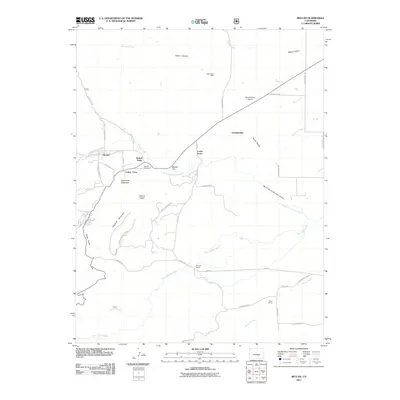
2011 Map of Beulah
USGS Topo · Published 2011About this map
Beulah Valley and its surrounding foothill settlements are the central focus of this 2011 survey, showing a landscape where residential pockets and ranching interests meet the rising terrain of the Wet Mountains. The area is defined by the drainage systems of the Saint Charles River and its northern fork, which carve through North Saint Charles Canyon and past landmarks like Sugarloaf Mountain. Local history and industry are evidenced by the Siloam Clay Mine near Wales Canyon and the Beulah Cemetery located just east of the main town center.
Find a feature on this map
48 named features on this map. Tap any name to fly to it.
Don’t see what you’re looking for? This feature index may not catch every label — zoom into the map to look around manually.
Map Details
Editions of this 2011 Beulah Map
This is the sole edition of this map. No revisions or reprints were ever made.
Other maps of this area

1889 · Canon City
USGS Topo · 1:125,000

1889 · Huerfano Park
USGS Topo · 1:125,000

1891 · Walsenburg
USGS Topo · 1:125,000

1891 · Pueblo
USGS Topo · 1:125,000

1892 · Huerfano Park
USGS Topo · 1:125,000

1892 · Canon City
USGS Topo · 1:125,000

1894 · Walsenburg
USGS Topo · 1:125,000

1894 · Pueblo
USGS Topo · 1:125,000

1896 · Pueblo
USGS Topo · 1:125,000

1897 · Pueblo
USGS Topo · 1:125,000