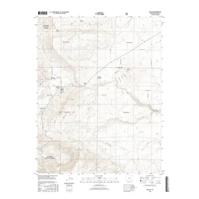
2016 Map of Beulah
USGS Topo · Published 2016About this map
Beulah and its neighboring settlements occupy the valley floor where Middle Cr and Squirrel Cr descend from the eastern fringes of the San Isabel National Forest. This 2016 survey highlights a residential pattern closely tied to the terrain, with homes concentrated along Valley View and the winding paths of Grand Ave and Northcreek Cut Off Rd. The landscape is defined by dramatic elevation changes, rising toward prominent summits like Sugarloaf Mtn, Mt Signal, and Hogback Mtn.
Find a feature on this map
59 named features on this map. Tap any name to fly to it.
Don’t see what you’re looking for? This feature index may not catch every label — zoom into the map to look around manually.
Map Details
Editions of this 2016 Beulah Map
This is the sole edition of this map. No revisions or reprints were ever made.
Other maps of this area

1889 · Canon City
USGS Topo · 1:125,000

1889 · Huerfano Park
USGS Topo · 1:125,000

1891 · Walsenburg
USGS Topo · 1:125,000

1891 · Pueblo
USGS Topo · 1:125,000

1892 · Huerfano Park
USGS Topo · 1:125,000

1892 · Canon City
USGS Topo · 1:125,000

1894 · Walsenburg
USGS Topo · 1:125,000

1894 · Pueblo
USGS Topo · 1:125,000

1896 · Pueblo
USGS Topo · 1:125,000

1897 · Pueblo
USGS Topo · 1:125,000