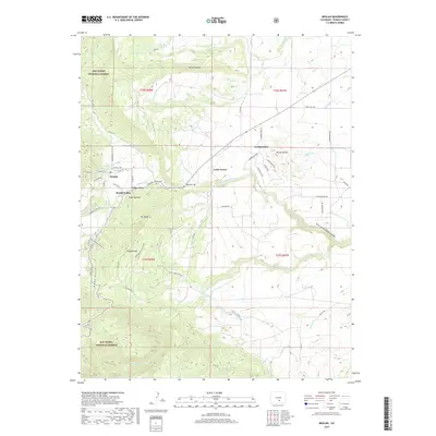
2019 Map of Beulah
USGS Topo · Published 2019About this map
The Saint Charles River winds through the heart of this Pueblo County landscape, carving dramatic terrain such as North Saint Charles Canyon. The cluster of settlements including Beulah, Valley View, and Beulah Valley sits at the foot of prominent peaks like Sugarloaf Mtn and Mt Signal. This area, heavily influenced by its proximity to the San Isabel National Forest, shows a complex network of local roads such as Pueblo Mountain Park Rd and Squirrel Creek Rd that connect the small communities to the surrounding high ground.
Find a feature on this map
59 named features on this map. Tap any name to fly to it.
Don’t see what you’re looking for? This feature index may not catch every label — zoom into the map to look around manually.
Map Details
Editions of this 2019 Beulah Map
This is the sole edition of this map. No revisions or reprints were ever made.
Other maps of this area

1889 · Canon City
USGS Topo · 1:125,000

1889 · Huerfano Park
USGS Topo · 1:125,000

1891 · Walsenburg
USGS Topo · 1:125,000

1891 · Pueblo
USGS Topo · 1:125,000

1892 · Huerfano Park
USGS Topo · 1:125,000

1892 · Canon City
USGS Topo · 1:125,000

1894 · Walsenburg
USGS Topo · 1:125,000

1894 · Pueblo
USGS Topo · 1:125,000

1896 · Pueblo
USGS Topo · 1:125,000

1897 · Pueblo
USGS Topo · 1:125,000