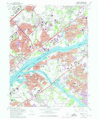
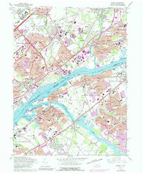
1966 Map of Beverly
USGS Topo · Published 1974About this map
The Delaware River serves as the central artery for this mid-century portrait of suburban expansion and industrial transport between Pennsylvania and New Jersey. On the Pennsylvania side, large institutional footprints such as the Philadelphia State Hospital and County Prison Farm dominate the landscape near Byberry Creek, while the Reading RR and Penn Central rail lines facilitate heavy industry and transit. Across the water, New Jersey’s riverside communities like Beverly and Delanco show a dense mix of residential streets and community landmarks, including the Beverly National Cemetery.
Find a feature on this map
167 named features on this map. Tap any name to fly to it.
Don’t see what you’re looking for? This feature index may not catch every label — zoom into the map to look around manually.
Map Details
Editions of this 1966 Beverly Map
5 editions found
Other maps of this area

1888 · Mount Holly
USGS Topo · 1:62,500

1890 · Burlington
USGS Topo · 1:62,500

1891 · Philadelphia
USGS Topo · 1:62,500

1893 · Germantown
USGS Topo · 1:62,500

1893 · Burlington
USGS Topo · 1:62,500

1894 · Mount Holly
USGS Topo · 1:62,500

1894 · Philadelphia
USGS Topo · 1:62,500

1894 · Germantown
USGS Topo · 1:62,500

1896 · Germantown
USGS Topo · 1:62,500

1896 · Philadelphia
USGS Topo · 1:62,500
Featured Places
- Philadelphia, PA
- Bensalem Township, PA
- Mount Laurel Township, NJ
- Willingboro Township, NJ
- Moorestown Township, NJ