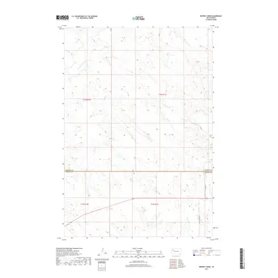
2017 Map of Beverly Creek
USGS Topo · Published 2017About this map
The S Fork Moreau River meanders through the northwest corner of this West River landscape, where the prairie topography is defined by an intricate network of intermittent drainage systems. The boundary between Perkins and Meade counties bisects the central portion of the map, marking a transition across this rural expanse. The drainage patterns of Beverly Cr, Frozen Man Cr, and Trail Cr illustrate the complex hydrology typical of the High Plains, where water courses carve subtle relief into the terrain. Human presence is sparse, delineated primarily by the orthogonal grid of township and range lines and a few north-south thoroughfares such as 165th Ave and Eagle Township Rd. This 2017 study captures a quiet section of South Dakota where the landscape remains largely dedicated to large-scale ranching and open space.
Find a feature on this map
12 named features on this map. Tap any name to fly to it.
Don’t see what you’re looking for? This feature index may not catch every label — zoom into the map to look around manually.
Map Details
Editions of this 2017 Beverly Creek Map
This is the sole edition of this map. No revisions or reprints were ever made.
Other maps of this area

1951 · Cedar Canyon
USGS Topo · 1:24,000

1951 · Imogene
USGS Topo · 1:24,000

1953 · Rapid City
USGS Topo · 1:250,000

1954 · Lemmon
USGS Topo · 1:250,000

1957 · Lemmon
USGS Topo · 1:250,000

1957 · Rapid City
USGS Topo · 1:250,000

1973 · Frozen Man Creek
USGS Topo · 1:24,000
1978 · Camp Creek
USGS Topo · 1:24,000

1980 · Beverly Creek
USGS Topo · 1:25,000

1980 · Zeona
USGS Topo · 1:25,000