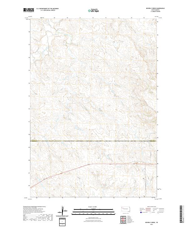
2021 Map of Beverly Creek
USGS Topo · Published 2021About this map
The S Fork Moreau River cuts through the northwest corner of this West River landscape, where the high plains are defined by an intricate network of seasonal drainages and creek beds. This 2021 survey documents the rural boundary where Perkins Co meets Meade Co, a region characterized by vast sections of open range and isolated ranch access roads. Water remains the primary geographical marker for land tracts in this area, with Beverly Cr and Trail Cr winding through the central township sections. Farther south, the terrain descends toward Frozen Man Cr and Spring Cr. Infrastructure is sparse, anchored primarily by north-south corridors such as 165th Ave and the traversing Eagle Township Rd, illustrating the modern layout of these expansive South Dakota counties.
Find a feature on this map
8 named features on this map. Tap any name to fly to it.
Don’t see what you’re looking for? This feature index may not catch every label — zoom into the map to look around manually.
Map Details
Editions of this 2021 Beverly Creek Map
This is the sole edition of this map. No revisions or reprints were ever made.
Other maps of this area

1951 · Cedar Canyon
USGS Topo · 1:24,000

1951 · Imogene
USGS Topo · 1:24,000

1953 · Rapid City
USGS Topo · 1:250,000

1954 · Lemmon
USGS Topo · 1:250,000

1957 · Lemmon
USGS Topo · 1:250,000

1957 · Rapid City
USGS Topo · 1:250,000

1973 · Frozen Man Creek
USGS Topo · 1:24,000
1978 · Camp Creek
USGS Topo · 1:24,000

1980 · Beverly Creek
USGS Topo · 1:25,000

1980 · Zeona
USGS Topo · 1:25,000