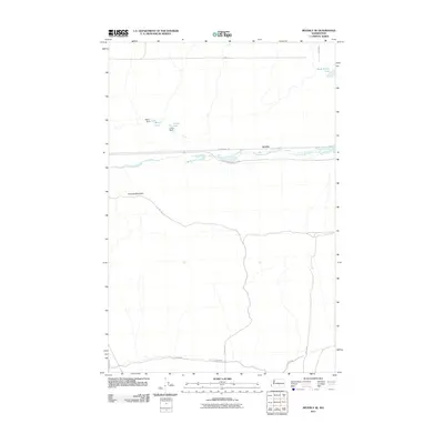
2011 Map of Beverly SE
USGS Topo · Published 2011About this map
Lower Crab Creek defines the east-west corridor of this arid Grant County landscape, providing a narrow band of water and vegetation through the desert. The small settlement of Jericho sits along the northern bank, positioned near the historic rail route now designated as the John Wayne Trl. This area is characterized by significant water management features, including Merry Dam and Lenice Dam, which create and maintain Merry Lake and Lenice Lake respectively. To the south, the massive bulk of Sentinel Mountain dominates the horizon, its northern slopes dropping toward the creek valley. Further north, the isolated Sand Hollow Lake sits near the junction of 15-SW Rd and L-S-SW Rd, illustrating the scattered water resources essential for habitation and agriculture in this part of Washington.
Find a feature on this map
18 named features on this map. Tap any name to fly to it.
Don’t see what you’re looking for? This feature index may not catch every label — zoom into the map to look around manually.
Map Details
Editions of this 2011 Beverly SE Map
This is the sole edition of this map. No revisions or reprints were ever made.
Other maps of this area

1911 · Red Rock
USGS Topo · 1:62,500

1912 · Beverly
USGS Topo · 1:62,500

1916 · Coyote Rapids
USGS Topo · 1:62,500

1917 · Priest Rapids
USGS Topo · 1:62,500

1948 · Priest Rapids
USGS Topo · 1:24,000

1950 · Smyrna
USGS Topo · 1:62,500

1951 · Priest Rapids
USGS Topo · 1:62,500

1951 · Smyrna
USGS Topo · 1:62,500

1951 · Coyote Rapids
USGS Topo · 1:62,500

1953 · Walla Walla
USGS Topo · 1:250,000