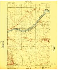
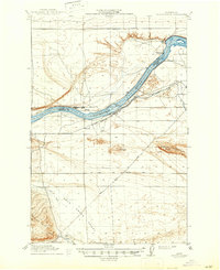
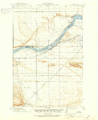
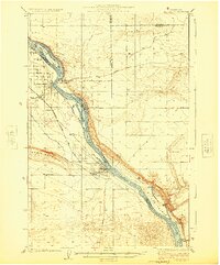
1916 Map of Coyote Rapids
USGS Topo · Published 1916About this map
The Columbia River cuts a deep arc through this arid landscape, serving as the primary corridor for early 20th-century development. Along its banks, the Chicago Milwaukee and St Paul railroad supports small riverside outposts like Allard and Haven Sta., while a nearby Pumping Plant and the Benson Ditch indicate the beginnings of irrigation-based settlement. This is the river before its modern transformation, where Coyote Rapids remains a distinct navigational feature and the Boundary Line separates Grant Co and Benton Co.
Find a feature on this map
21 named features on this map. Tap any name to fly to it.
Don’t see what you’re looking for? This feature index may not catch every label — zoom into the map to look around manually.
Map Details
Editions of this 1916 Coyote Rapids Map
3 editions found
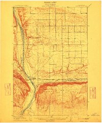
Other maps of this area

1911 · Red Rock
USGS Topo · 1:62,500
1912 · Beverly
USGS Topo · 1:62,500

1915 · Prosser
USGS Topo · 1:125,000

1917 · Pasco
USGS Topo · 1:125,000

1917 · Priest Rapids
USGS Topo · 1:62,500

1917 · Prosser
USGS Topo · 1:125,000

1923 · Corfu
USGS Topo · 1:62,500
1924 · Hanford
USGS Topo · 1:62,500
1948 · Emerson Nipple
USGS Topo · 1:24,000

1950 · Smyrna
USGS Topo · 1:62,500