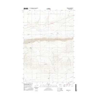
2017 Map of Beverly SE
USGS Topo · Published 2017About this map
The Jericho settlement site sits at the northern base of the Saddle Mountains, a region defined by dramatic elevation changes in central Washington. This 2017 survey details the complex terrain where the steep northern face of Sentinel Mtn drops toward the low-lying basin of Lower Crab Creek. The landscape transition is marked by a network of rural routes, including the historic Milwaukee Rd corridor and local paths such as Rd 17 Sw. To the south, the land levels out across the Wahluke Slope, an area known for its unique agricultural and geological profile. Hydrological features like Sand Hollow Lake and Merry Lake appear alongside Wilson Spring, providing critical water points in this arid environment. The map offers a clear view of the township and range boundaries, specifically t16n r24e and t15n r24e, reflecting the structured land management of the Columbia Basin.
Find a feature on this map
23 named features on this map. Tap any name to fly to it.
Don’t see what you’re looking for? This feature index may not catch every label — zoom into the map to look around manually.
Map Details
Editions of this 2017 Beverly SE Map
This is the sole edition of this map. No revisions or reprints were ever made.
Other maps of this area

1911 · Red Rock
USGS Topo · 1:62,500

1912 · Beverly
USGS Topo · 1:62,500

1916 · Coyote Rapids
USGS Topo · 1:62,500

1917 · Priest Rapids
USGS Topo · 1:62,500

1948 · Priest Rapids
USGS Topo · 1:24,000

1950 · Smyrna
USGS Topo · 1:62,500

1951 · Priest Rapids
USGS Topo · 1:62,500

1951 · Smyrna
USGS Topo · 1:62,500

1951 · Coyote Rapids
USGS Topo · 1:62,500

1953 · Walla Walla
USGS Topo · 1:250,000