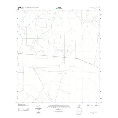
2013 Map of Biel Lake NE
USGS Topo · Published 2013About this map
Charamusca Oil Field sits in the northeast portion of this South Texas landscape, illustrating the region's long-standing connection to energy production. The terrain is defined by a sparse network of watercourses, most notably the winding paths of Black Cr and Charamusca Cr, which drain toward the southeast. The area is characterized by large, open tracts of land typical of Webb County ranching and petroleum country, where human impact is primarily limited to resource extraction and the linear grid of county roads. A primary transit corridor, Cord-401, cuts through the eastern half of the map, while the intermittent Colmena Cr meanders across the southern sections. This 2013 record reflects a landscape largely dedicated to industrial and agricultural utility, with little in the way of dense residential settlement.
Find a feature on this map
5 named features on this map. Tap any name to fly to it.
Don’t see what you’re looking for? This feature index may not catch every label — zoom into the map to look around manually.
Map Details
Editions of this 2013 Biel Lake NE Map
This is the sole edition of this map. No revisions or reprints were ever made.
Other maps of this area

1937 · Loma Alta
USGS Topo · 1:62,500

1953 · Crystal City
USGS Topo · 1:250,000

1955 · Crystal City
USGS Topo · 1:250,000

1956 · Freer
USGS Topo · 1:62,500

1956 · Piedra Creek
USGS Topo · 1:62,500

1956 · Las Mujeres
USGS Topo · 1:62,500

1956 · Laredo
USGS Topo · 1:250,000

1961 · Crystal City
USGS Topo · 1:250,000

1968 · Crystal City
USGS Topo · 1:250,000
1969 · Mirasol Creek
USGS Topo · 1:24,000