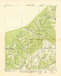
1935 Map of Big A Mountain
USGS Topo · Published 1935About this map
The Buchanan Russell Co line divides this terrain, following the high ridges between the Russell Fork and Thompson Creek watersheds during the mid-1930s. The landscape is defined by its numerous family-named landmarks and remote upland communities like Council and Combs. Education and faith served as the primary social anchors for these hollows, evidenced by the high density of small facilities such as Crabtree Sch, Grissom Sch, and Austin Chapel. Transport in the southern section of the quadrangle is anchored by the Norfolk and Western RR and State Highway No 80, while the interior relies on a network of trails and primitive roads traversing points like Bowen Gap and Bradley Gap. The mapping reveals a settlement pattern strictly dictated by the intricate drainage systems of Garden Creek and Weaver Creek.
Find a feature on this map
65 named features on this map. Tap any name to fly to it.
Don’t see what you’re looking for? This feature index may not catch every label — zoom into the map to look around manually.
Map Details
Editions of this 1935 Big A Mountain Map
This is the sole edition of this map. No revisions or reprints were ever made.
Other maps of this area

1886 · Grundy
USGS Topo · 1:125,000

1890 · Grundy
USGS Topo · 1:125,000

1891 · Tazewell
USGS Topo · 1:125,000

1891 · Abingdon
USGS Topo · 1:125,000

1892 · Grundy
USGS Topo · 1:125,000

1894 · Abingdon
USGS Topo · 1:125,000

1895 · Tazewell
USGS Topo · 1:125,000

1897 · Tazewell
USGS Topo · 1:125,000

1897 · Bristol
USGS Topo · 1:125,000

1902 · Bristol
USGS Topo · 1:125,000