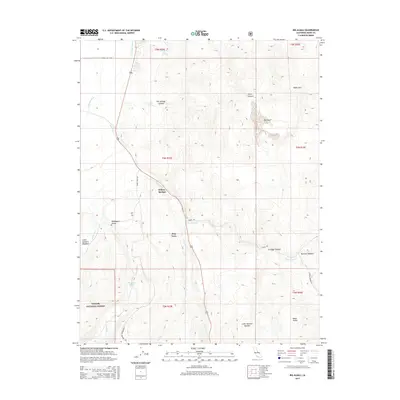
2015 Map of Big Alkali
USGS Topo · Published 2015About this map
Willow Springs and Dog Town anchor this eastern Sierra landscape, characterized by geothermal features and high-altitude basins within the Toiyabe National Forest. The presence of Travertine Hot Spring and The Hot Spring in Hot Springs Canyon highlights the area's volcanic legacy, which also shapes the eastern Bodie Hills. Water management is central to the area's geography, visible in the drainage of the E Walker River and the collection of Dynamo Pond.
Find a feature on this map
33 named features on this map. Tap any name to fly to it.
Don’t see what you’re looking for? This feature index may not catch every label — zoom into the map to look around manually.
Map Details
Editions of this 2015 Big Alkali Map
This is the sole edition of this map. No revisions or reprints were ever made.
Other maps of this area

1909 · Bridgeport
USGS Topo · 1:125,000

1911 · Bridgeport
USGS Topo · 1:125,000

1920 · Bridgeport
USGS Topo · 1:125,000

1948 · Walker Lake
USGS Topo · 1:250,000

1956 · Fales Hot Springs
USGS Topo · 1:62,500

1956 · Matterhorn Peak
USGS Topo · 1:62,500

1957 · Walker Lake
USGS Topo · 1:250,000

1958 · Bodie
USGS Topo · 1:62,500
1958 · Bridgeport
USGS Topo · 1:62,500

1962 · Walker Lake
USGS Topo · 1:250,000