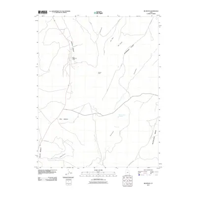
2010 Map of Big Bench
USGS Topo · Published 2010About this map
White Mesa dominates the western portion of this San Juan County landscape, providing a high-ground foundation for the settlement of White Mesa. This desert plateau region is defined by deep incisions and drainage patterns, specifically those of Recapture Creek and Horse Creek, which carve through the arid terrain. The map captures a moment of modern land management in an ancient landscape, where infrastructure like the Horse Canyon Reservoir and designated grazing areas such as Cowboy Pasture highlight the agricultural adaptation of the high desert. To the east, the terrain rises toward Shumway Point and the broad expanses of McCRACKEN MESA. The road network, including Indian Rte 204 and Adams RD, provides the primary connective tissue between these remote points, following the natural contours of the benches and canyons.
Find a feature on this map
27 named features on this map. Tap any name to fly to it.
Don’t see what you’re looking for? This feature index may not catch every label — zoom into the map to look around manually.
Map Details
Editions of this 2010 Big Bench Map
This is the sole edition of this map. No revisions or reprints were ever made.
Other maps of this area

1886 · Abajo
USGS Topo · 1:250,000

1892 · Abajo
USGS Topo · 1:250,000

1893 · Abajo
USGS Topo · 1:250,000

1935 · Elk Ridge
USGS Topo · 1:96,000

1940 · Elk Ridge
USGS Topo · 1:125,000

1955 · Verdure 3 SE
USGS Topo · 1:24,000

1956 · Cortez
USGS Topo · 1:250,000

1957 · Elk Ridge 4 SE
USGS Topo · 1:24,000

1957 · Brushy Basin Wash
USGS Topo · 1:62,500

1957 · Blanding
USGS Topo · 1:62,500