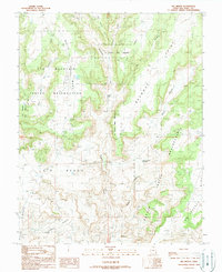
1989 Map of Big Bench
USGS Topo · Published 1989About this map
White Mesa dominates the northern landscape of this San Juan County territory, providing a high vantage point above the complex drainage systems of Recapture Creek and Cottonwood Wash. The map records a significant intersection of tribal lands, showing the southern boundary of the Ute Mountain Indian Reservation meeting the northern edge of the Navajo Indian Reservation. This confluence of jurisdictions is marked by the presence of Fiddlers Green, a small named settlement located near the center of the sheet.
Find a feature on this map
19 named features on this map. Tap any name to fly to it.
Don’t see what you’re looking for? This feature index may not catch every label — zoom into the map to look around manually.
Map Details
Editions of this 1989 Big Bench Map
This is the sole edition of this map. No revisions or reprints were ever made.
Other maps of this area

1886 · Abajo
USGS Topo · 1:250,000

1892 · Abajo
USGS Topo · 1:250,000

1893 · Abajo
USGS Topo · 1:250,000

1935 · Elk Ridge
USGS Topo · 1:96,000

1940 · Elk Ridge
USGS Topo · 1:125,000

1955 · Verdure 3 SE
USGS Topo · 1:24,000

1956 · Cortez
USGS Topo · 1:250,000

1957 · Elk Ridge 4 SE
USGS Topo · 1:24,000

1957 · Brushy Basin Wash
USGS Topo · 1:62,500

1957 · Blanding
USGS Topo · 1:62,500