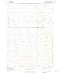
1973 Map of Big Bend Dam 4 SW
USGS Topo · Published 1976About this map
Old Indian Treaty Boundary lines cross this Buffalo County landscape, marking the historical intersection of tribal lands and federal survey divisions. The terrain is defined by the winding paths of Elm Creek and Crow Creek, which drain the open prairie of the Crow Creek Indian Reservation Boundary. This 1973 survey focuses on a quiet stretch of South Dakota rangeland where fence and field lines are noted as distinct topographic markers. The absence of concentrated settlements emphasizes the vast, agricultural nature of the reservation land during the mid-1970s, providing a clear record of the physical boundaries and water sources that dictated land use in the Big Bend region.
Find a feature on this map
4 named features on this map. Tap any name to fly to it.
Don’t see what you’re looking for? This feature index may not catch every label — zoom into the map to look around manually.
Map Details
Editions of this 1973 Big Bend Dam 4 SW Map
2 editions found
Other maps of this area

1935 · Chamberlain
USGS Topo · 1:62,500

1939 · Chamberlain
USGS Topo · 1:62,500

1941 · Pukwana
USGS Topo · 1:62,500

1951 · Pukwana
USGS Topo · 1:62,500

1953 · Huron
USGS Topo · 1:250,000

1954 · Huron
USGS Topo · 1:250,000

1955 · Mitchell
USGS Topo · 1:250,000

1959 · Mitchell
USGS Topo · 1:250,000

1966 · Big Bend Dam NE
USGS Topo · 1:24,000

1966 · Big Bend Dam SE
USGS Topo · 1:24,000
Featured Places
- Fort Thompson District, SD
- Pershing Township, SD
- Crow Creek District, SD
- Wilson Township, Crow Creek District
- Dewey Township, Crow Creek District