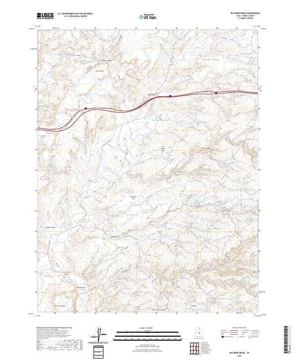
2023 Map of Big Bend Draw
USGS Topo · Published 2023About this map
Muddy Creek flows through the southern portion of this landscape, forming the prominent geological feature known as The Big Bend. This area of the San Rafael Swell is defined by its complex drainage network and elevated landforms, including Reeds Mesa and the Lone Tree Wedge. Significant water sources in this arid environment are marked by distinct labels such as Clyde and Neils Pond, Chris Pond, and Broken Pond, while deep incisions in the earth are visible at Devils Canyon and Cat Canyon. The presence of the The Dike near the southern boundary and the Lower Kimball Seep along Kimball Draw highlights the unique hydrological and geological makeup of Emery County. Transport through this territory is facilitated by Interstate 70 and local routes like County Road 923.
Find a feature on this map
27 named features on this map. Tap any name to fly to it.
Don’t see what you’re looking for? This feature index may not catch every label — zoom into the map to look around manually.
Map Details
Editions of this 2023 Big Bend Draw Map
This is the sole edition of this map. No revisions or reprints were ever made.
Other maps of this area

1885 · San Rafael
USGS Topo · 1:250,000

1885 · Fish Lake
USGS Topo · 1:250,000

1896 · Fish Lake
USGS Topo · 1:250,000

1952 · Wild Horse
USGS Topo · 1:62,500

1952 · San Rafael Knob
USGS Topo · 1:62,500

1953 · Emery 4 NE
USGS Topo · 1:24,000

1953 · Emery 1 NE
USGS Topo · 1:24,000

1953 · Emery 1 SE
USGS Topo · 1:24,000

1954 · Stinking Spring Creek 3 NW
USGS Topo · 1:24,000

1954 · Stinking Spring Creek 2 SW
USGS Topo · 1:24,000