
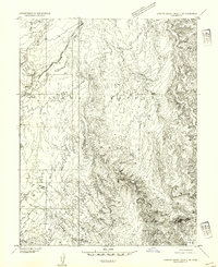
1953 Map of Emery 1 SE
USGS Topo · Published 1954About this map
Dennises Well and the seasonal drainages of Emery County define this 1950s landscape within the San Rafael Swell region. The map captures a moment when the desert interior was primarily utilized for stock raising and limited exploration, marked by lonely outposts like the Lone Tree (Camp Site) along the banks of the Muddy River.
Find a feature on this map
8 named features on this map. Tap any name to fly to it.
Don’t see what you’re looking for? This feature index may not catch every label — zoom into the map to look around manually.
Map Details
Editions of this 1953 Emery 1 SE Map
This is the sole edition of this map. No revisions or reprints were ever made.
Other maps of this area

1885 · San Rafael
USGS Topo · 1:250,000

1885 · Fish Lake
USGS Topo · 1:250,000

1896 · Fish Lake
USGS Topo · 1:250,000

1952 · Wild Horse
USGS Topo · 1:62,500

1952 · San Rafael Knob
USGS Topo · 1:62,500

1953 · Emery 4 NE
USGS Topo · 1:24,000

1953 · Emery 1 NE
USGS Topo · 1:24,000

1954 · Stinking Spring Creek 3 NW
USGS Topo · 1:24,000

1954 · Stinking Spring Creek 2 SW
USGS Topo · 1:24,000
1954 · Stinking Spring Creek 2 NW
USGS Topo · 1:24,000