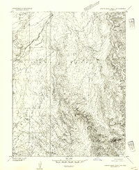
1954 Map of Stinking Spring Creek 2 NW
USGS Topo · Published 1954About this map
San Rafael Swell dominates this mid-century topographic study, revealing a complex network of drainage systems and high plateaus in Emery County. This preliminary edition, derived from 1951 aerial photography, focuses on the intricate erosion patterns typical of the region's geological uplift. Named watercourses such as the North Fork Salt Wash and South Salt Wash carve through the landscape, while Coal Wash and its North Fork define the eastern drainage. A notable human or historical landmark identified on the sheet is Sid and Charley, located near the northern reaches of the survey. The map also delineates topographic features like Wood Hollow and the elevated Secret Mesa, providing a detailed view of the terrain as it existed before later developmental changes or formal designation of the surrounding wilderness areas.
Find a feature on this map
10 named features on this map. Tap any name to fly to it.
Don’t see what you’re looking for? This feature index may not catch every label — zoom into the map to look around manually.
Map Details
Editions of this 1954 Stinking Spring Creek 2 NW Map
This is the sole edition of this map. No revisions or reprints were ever made.
Other maps of this area

1885 · San Rafael
USGS Topo · 1:250,000

1885 · Manti
USGS Topo · 1:250,000

1885 · Fish Lake
USGS Topo · 1:250,000

1886 · Price River
USGS Topo · 1:250,000

1895 · Manti
USGS Topo · 1:250,000

1896 · Price River
USGS Topo · 1:250,000

1896 · Fish Lake
USGS Topo · 1:250,000

1923 · Castle Dale
USGS Topo · 1:62,500

1925 · Castle Dale
USGS Topo · 1:62,500

1952 · San Rafael Knob
USGS Topo · 1:62,500