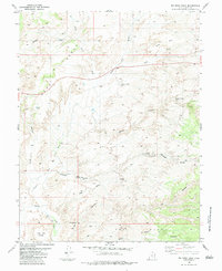
1983 Map of Big Bend Draw
USGS Topo · Published 1983About this map
Muddy Creek carves a sharp oxbow at The Big Bend in this southern portion of the San Rafael Swell area. This high desert terrain is defined by a complex network of intermittent drainages including Whiskey Wash, Bitter Wash, and Mulligan Wash that feed into the larger canyon systems. Geologic features such as The Dike and the broad plateau of Reed Mesa dominate the topography, interspersed with small water sources critical to the region, such as Chris Pond and Clyde and Neils Pond.
Find a feature on this map
34 named features on this map. Tap any name to fly to it.
Don’t see what you’re looking for? This feature index may not catch every label — zoom into the map to look around manually.
Map Details
Editions of this 1983 Big Bend Draw Map
This is the sole edition of this map. No revisions or reprints were ever made.
Other maps of this area

1885 · San Rafael
USGS Topo · 1:250,000

1885 · Fish Lake
USGS Topo · 1:250,000

1896 · Fish Lake
USGS Topo · 1:250,000

1952 · Wild Horse
USGS Topo · 1:62,500

1952 · San Rafael Knob
USGS Topo · 1:62,500

1953 · Emery 4 NE
USGS Topo · 1:24,000

1953 · Emery 1 NE
USGS Topo · 1:24,000

1953 · Emery 1 SE
USGS Topo · 1:24,000

1954 · Stinking Spring Creek 3 NW
USGS Topo · 1:24,000

1954 · Stinking Spring Creek 2 SW
USGS Topo · 1:24,000