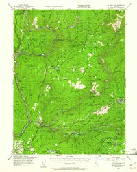
1948 Map of Big Bend Mtn
USGS Topo · Published 1961About this map
The rugged Sierra Nevada foothills of Butte County are defined by the deep canyons of the Feather River forks. At this post-war moment, the Western Pacific Railroad snakes along the North Fork Feather River, serving small settlements like Las Plumas and the Berry Creek Station. The landscape is a mix of active mining operations and established ranches, with names like Bunker Hill Mine and Surcease Mine appearing alongside the Jamison Ranch and Hinton Ranch.
Find a feature on this map
122 named features on this map. Tap any name to fly to it.
Don’t see what you’re looking for? This feature index may not catch every label — zoom into the map to look around manually.
Map Details
Editions of this 1948 Big Bend Mtn Map
4 editions found

Other maps of this area

1888 · Marysville
USGS Topo · 1:125,000

1888 · Smartsville
USGS Topo · 1:125,000

1888 · Bidwell Bar
USGS Topo · 1:125,000

1891 · Bidwell Bar
USGS Topo · 1:125,000

1891 · Chico
USGS Topo · 1:125,000

1891 · Marysville
USGS Topo · 1:125,000

1891 · Smartsville
USGS Topo · 1:125,000

1892 · Smartsville
USGS Topo · 1:125,000

1893 · Chico
USGS Topo · 1:125,000

1893 · Bidwell Bar
USGS Topo · 1:125,000