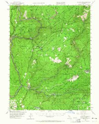
1948 Map of Big Bend Mtn
USGS Topo · Published 1965About this map
The North Fork Feather River carves a deep path through the canyon lands of the Plumas National Forest, where the Western Pacific RR follows the steep river grade toward Las Plumas. This landscape is defined by the intersections of early mountain industry and scattered settlements. To the south, the timber and mining communities of Enterprise and Forbestown mark the transition toward the Yuba County line, while isolated ranches like Schaefer Ranch and Andy Smith Ranch dot the higher ridges.
Find a feature on this map
92 named features on this map. Tap any name to fly to it.
Don’t see what you’re looking for? This feature index may not catch every label — zoom into the map to look around manually.
Map Details
Editions of this 1948 Big Bend Mtn Map
4 editions found

Other maps of this area

1888 · Marysville
USGS Topo · 1:125,000

1888 · Smartsville
USGS Topo · 1:125,000

1888 · Bidwell Bar
USGS Topo · 1:125,000

1891 · Bidwell Bar
USGS Topo · 1:125,000

1891 · Chico
USGS Topo · 1:125,000

1891 · Marysville
USGS Topo · 1:125,000

1891 · Smartsville
USGS Topo · 1:125,000

1892 · Smartsville
USGS Topo · 1:125,000

1893 · Chico
USGS Topo · 1:125,000

1893 · Bidwell Bar
USGS Topo · 1:125,000