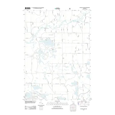
2012 Map of Big Blue Lake
USGS Topo · Published 2012About this map
The White River and its multiple branches, including the N Br White River and S Br White River, define the northern drainage of this Muskegon County landscape. Centered around the prominent Big Blue Lake, the region is a hub for mid-century recreational history, featuring several organized camps such as Camp Pendalouah, Camp Emery, and Camp Hardy. The map reveals a dense concentration of smaller kettle lakes, including Cleveland Lake, Mayo Lake, and Ergang Lake, many of which remained undeveloped or served by primitive roads like Holton Whitehall Rd. Local history and genealogy interest is anchored by the Blue Lake Cem and Wave Cem, while access to the waterways is noted at the Sischo Canoe Landing and Diamond Access Canoe Landing, reflecting the area's long-standing reliance on the river system for recreation and travel.
Find a feature on this map
66 named features on this map. Tap any name to fly to it.
Don’t see what you’re looking for? This feature index may not catch every label — zoom into the map to look around manually.
Map Details
Editions of this 2012 Big Blue Lake Map
This is the sole edition of this map. No revisions or reprints were ever made.
Other maps of this area

1929 · Montague
USGS Topo · 1:48,000

1931 · Hart SE
USGS Topo · 1:31,680

1931 · Walkerville SW
USGS Topo · 1:31,680

1931 · Walkerville SE
USGS Topo · 1:31,680

1954 · Milwaukee
USGS Topo · 1:250,000

1958 · Milwaukee
USGS Topo · 1:250,000

1958 · Hesperia
USGS Topo · 1:62,500

1958 · Twin Lake
USGS Topo · 1:62,500

1959 · Montague
USGS Topo · 1:62,500

1959 · Hart
USGS Topo · 1:62,500
Featured Places
- Lakewood Club, MI
- Otto Township, MI
- Greenwood Township, MI
- Lakewood, Lakewood Club
- Cedar Creek Township, MI