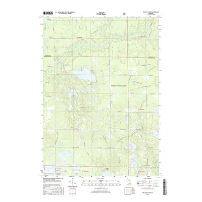
2017 Map of Big Blue Lake
USGS Topo · Published 2017About this map
The White River and its South Branch carve a complex path through the northern reaches of this landscape, feeding into wetland areas like Sischo Bayou. This portion of the Manistee National Forest is defined by a high density of kettle lakes and smaller water bodies, including Big Blue Lake, Crystal Lake, and Pine Island Lake. The settlement patterns of Lakewood Club and Twin Lake in the south reflect a community closely tied to these waters, with local history preserved at Blue Lake Cem and Wave Cem. A network of unpaved paths and the extensive Holton Motorcycle Trail winds through the woodland, illustrating the modern recreational use of this glacial terrain. The map also captures the transition from the forested interior to the creek systems of Cleveland Creek and Skeel Cr as they drain toward the larger river basins.
Find a feature on this map
85 named features on this map. Tap any name to fly to it.
Don’t see what you’re looking for? This feature index may not catch every label — zoom into the map to look around manually.
Map Details
Editions of this 2017 Big Blue Lake Map
This is the sole edition of this map. No revisions or reprints were ever made.
Other maps of this area

1929 · Montague
USGS Topo · 1:48,000

1931 · Hart SE
USGS Topo · 1:31,680

1931 · Walkerville SW
USGS Topo · 1:31,680

1931 · Walkerville SE
USGS Topo · 1:31,680

1954 · Milwaukee
USGS Topo · 1:250,000

1958 · Milwaukee
USGS Topo · 1:250,000

1958 · Hesperia
USGS Topo · 1:62,500

1958 · Twin Lake
USGS Topo · 1:62,500

1959 · Montague
USGS Topo · 1:62,500

1959 · Hart
USGS Topo · 1:62,500
Featured Places
- Lakewood Club, MI
- Otto Township, MI
- Greenwood Township, MI
- Lakewood, Lakewood Club
- Cedar Creek Township, MI