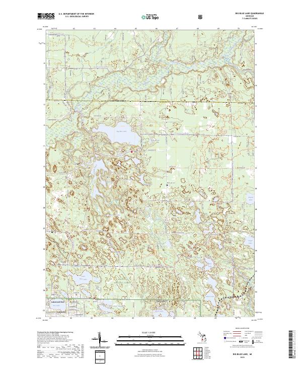
2023 Map of Big Blue Lake
USGS Topo · Published 2023About this map
Big Blue Lake and the winding course of the White River dominate this landscape within the Manistee National Forest. The map reveals a dense concentration of glacial kettle lakes and wetlands along the border of Oceana and Muskegon counties, including Britton Lake, Sweet Lake, and Pine Island Lake. To the south, the village of Lakewood Club and the settlement at Twin Lake show the organized residential development of the modern era, while rural landmarks like Blue Lake Cemetery and Ware Cemetery provide important markers for local genealogical research. The complex hydrography of the region is further defined by the North Branch White River and South Branch White River, which intersect with various forest service trails and local routes like Fruitvale Road, illustrating the intersection of conservation land and recreational development.
Find a feature on this map
96 named features on this map. Tap any name to fly to it.
Don’t see what you’re looking for? This feature index may not catch every label — zoom into the map to look around manually.
Map Details
Editions of this 2023 Big Blue Lake Map
This is the sole edition of this map. No revisions or reprints were ever made.
Other maps of this area

1929 · Montague
USGS Topo · 1:48,000

1931 · Hart SE
USGS Topo · 1:31,680

1931 · Walkerville SW
USGS Topo · 1:31,680

1931 · Walkerville SE
USGS Topo · 1:31,680

1954 · Milwaukee
USGS Topo · 1:250,000

1958 · Milwaukee
USGS Topo · 1:250,000

1958 · Hesperia
USGS Topo · 1:62,500

1958 · Twin Lake
USGS Topo · 1:62,500

1959 · Montague
USGS Topo · 1:62,500

1959 · Hart
USGS Topo · 1:62,500