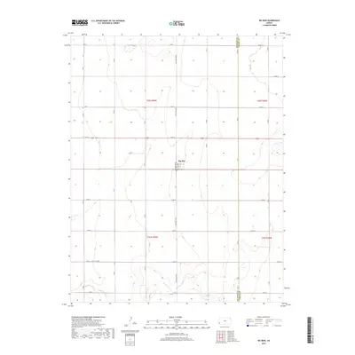
2018 Map of Big Bow
USGS Topo · Published 2018About this map
The settlement of Big Bow sits at the heart of this high-plains landscape in southwestern Kansas, positioned along the border between Stanton Co and Grant Co. The terrain is defined by a rigid grid of agricultural roads, including N Big Bow Grade and S Big Bow Grade, which cut across the prairie to organize the vast sections of t28s r39w and t29s r39w. In the southern portion of the map, the seasonal drainage of Sand Arroyo Cr meanders through the landscape, providing a natural break in the geometric regularity of the section lines. This 2018 survey illustrates the enduring agricultural character of the region, where a sparse population is clustered around the central grain-handling and residential hub of Big Bow, surrounded by miles of strictly surveyed farmland typical of the Great Plains' rural infrastructure.
Find a feature on this map
33 named features on this map. Tap any name to fly to it.
Don’t see what you’re looking for? This feature index may not catch every label — zoom into the map to look around manually.
Map Details
Editions of this 2018 Big Bow Map
This is the sole edition of this map. No revisions or reprints were ever made.
Other maps of this area

1891 · Larned
USGS Topo · 1:125,000

1900 · Syracuse
USGS Topo · 1:125,000

1900 · Lakin
USGS Topo · 1:125,000

1920 · Syracuse
USGS Topo · 1:125,000

1955 · Dodge City
USGS Topo · 1:250,000

1958 · Dodge City
USGS Topo · 1:250,000

1959 · Dodge City
USGS Topo · 1:250,000

1959 · Ulysses NW
USGS Topo · 1:24,000

1959 · Big Bow NE
USGS Topo · 1:24,000

1959 · Big Bow NW
USGS Topo · 1:24,000